Filter By
Open Opportunities
Space GNSS Receiver for In-Orbit Demonstration of PPP
The object of the activity is to design, develop and validate/verified a GNSS space receiver capable to perform on board precise orbit determination (P2OD) in real time using precise GNSS orbit and clock corrections provided either by Geostationary satellites or Galileo Commercial Service (thus allowing on board autonomy w.r.t to ground stations).
The concept is similar to what is performed on…
esa-STAR link: http://emits.sso.esa.int/emits/owa/emits.main
Weather Monitoring Based on Collaborative Crowdsourcing
The measurement of Integrated Water Vapour using GNSS stations from a network of reference stations have been demonstrated.
During the last years, the existence of multi- constellation and multi-frequency GNSS increases the effectiveness and reliability of such measurements for weather prediction. Currently the availability of affordable powerful hand-held GNSS receivers with…
esa-STAR link: http://emits.sso.esa.int/emits/owa/emits.main
Cooperative Navigation and Cloud Processing
The current evolution of the Internet of Things (IoT) and Smart Cities, together with the proliferation in the last years of cloud platforms where storage and processing of data can, ideally, be handled on demand, has boosted the appearance of new applications and services in the positioning domain of potential interest for specific use cases. In particular, the processing in the cloud of GNSS…
esa-STAR link: http://emits.sso.esa.int/emits/owa/emits.main
Pulsar Timescale Demonstration
The objective of this activity is to demonstrate the effectiveness of Pulsar Timescale for the generation and monitoring of Position, Navigation and Timing (PNT) and Global Navigation Satellite System (GNSS) time.
For the latter, the capabilities of the Galileo Processing Centre at ESA/ESTEC in terms of access to Galileo Experimental Sensor Stations and data processing capabilities will be…
esa-STAR link: http://emits.sso.esa.int/emits/owa/emits.main
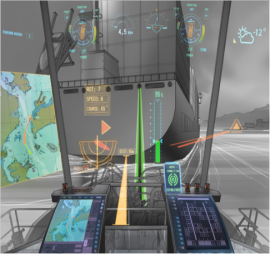
Multipath & Interference Error Mitigation Techniques for Future Maritime e-NAV Services
The study, characterisation, modelling and mitigation of multipath and interference in maritime environments for different operational scenarios are considered of paramount importance.
The objectives of this activity are to characterise the multipath and interference errors experienced by marine PNT receivers, in particular GNSS, and to derive suitable error models for maritime space-based PNT…
esa-STAR link: http://navisp.innobyte.ro/page/esa-star
Multi-System Multi-Sensor Maritime PNT Test Equipment
The activity "Multi-System Multi-Sensor Maritime PNT Test Equipment" will tackle the study of methods and techniques for the combined use of multiple systems and sensors inmaritime PNT receivers to characterise achievable classes of performance.
At the same time is will also require the implementation of an experimental platform for testing and benchmarking the combination of methods and…
esa-STAR link: http://emits.sso.esa.int/emits/owa/emits.main
Open Call for Proposals
Submit a 6 pages Outline Proposal
Under NAVISP Element 2, the permanent Open Call for Proposals focusses on the development of innovative competitive products in the Satellite Navigation and wider Position, Navigation and Timing domain.
The objective is to boost Member States industrial competitiveness in the fast- evolving navigation sector.
Proposals are welcome from space and…
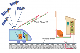
System Suitability Study for Train Positioning Using GNSS in ERTMS in 2020
The objective of this activity is to study the suitability of the current generation of SBAS for use in an evolution of the European Rail Traffic Management System (ERTMS) using GNSS for virtual balise detection.
This activity focuses on the current generation of the European SBAS, EGNOS v2 (GPS L1 only) and includes the following aspects:
Review and consolidate requirements and…
esa-STAR link: http://emits.sso.esa.int/emits/owa/emits.main
Complementary PNT Infrastructure in LEO
GNSS is the only global, free, comprehensive technology providing absolute PNT data to users worldwide.
Its limitations are known, including long life cycle and replenishment schedule, affecting their ability to adapt easily to short term market needs and to some extent, resilience. Considering the above, alternative PNT methods and solutions have been developed, innovative PNT systems are…
esa-STAR link: http://emits.sso.esa.int/emits/owa/emits.main
test price range
sfvsfvsf


